John Stringfellow, September 2020
 |
 |
I do not support the words “Kokoda Track” to describe where the fighting took place in what was the Kokoda Trail Campaign from July 1942 to February 1943 which was fought to repel the Japanese Army from Papua. The fighting in the mountains was only part of the campaign.
The word track is in common use these days to describe the heroics of the Kokoda Trail Campaign. However, it should be remembered that over two thirds of the Australians killed in the campaign occurred, not on the actual trail as described by the Australian War Memorial but on the coastal side of the Kumusi River when they assaulted and drove off the Japanese from the coastal villages.
Prior to 1942 there was no Kokoda trail or track. A prewar mail route between Port Moresby and the European settlements on the north coast existed which would have had relay points along the way due to the various languages spoken and the warlike nature of the many Papuans inhabiting the villages along the route.
The Australian War Memorial describes the Kokoda Trail as being “a path that linked Owers Corner, approximately 40km north-east of Port Moresby and the small village of Wairopi on the northern side of the Owen Stanley Mountain range. From Wairopi, a crossing point on the Kumusi River, the Trail was connected to the settlements of Buna, Gona and Sanananda on the north coast. Its name was derived from the village of Kokoda that stood on the northern side of the main range and was the site of the only airfield between Port Moresby and the north coast.” This path generallyfollowed the prewar mail route between Port Moresby and Buna.
The Kokoda Trail Campaign started when the Japanese landed at Buna and reached the village of Ioribaiwa before they were driven back to Buna, Gona and Sanananda by Australian troops with support from the Australian and the USA air forces. Here they were joined by a detachment of USA troops where, with additional support from the USA navy, they destroyed the remnant Japanese army units that had fought along the Trail. The USA air and naval forces had a major role in preventing the Japanese from reinforcing and resupplying its land force on the Trail.
The Army’s general staff in 1942 had recognized the existence of multiple paths parallel to and branching off the mail route paths linking the villages from Owers Corner to Wairopi and issued orders for the mail route paths to be called the Kokoda Trail.
Press reports at the time, and subsequent historians, have called the main paths the Kokoda Track which they are reported to have done so in deference to the troops they had interviewed who had fought along the trail. However, they recognize that there were several different tracks along the main track. It is of interest that Dudley McCarthy, the official war historian who wrote the history of the Kokoda Trail Campaign published in 1959 has, in his history, reproduced a map of the route over the Owen Stanleys from Port Moresby to past the Kumusi River which he titles “The Kokoda Track” however the words “Kokoda Trail” are written on the map alongside of the paths between the villages of Uberi and Efogi by the cartographer. I assume McCarthy obtained this map from Army archives.
So, who is correct the general staff or the troops?
Bert Kienzle called it a Trail. He was a planter and miner who was a long-term resident of Kokoda when the war broke out and he played a significant role during the fighting, He was appointed by the general staff to be in command of the Papuan porters who resupplied the troops and helped evacuate the wounded. He also cut other paths away from the prewar mail route including a bypass track to Myola from the Efogi village to Templeton’s Crossing to make the resupply of the forward troops and the evacuation of the wounded faster and easier.
His initial crossing of the Owen Stanleys on foot using the prewar mail route was to report to the Army’s general staff in Port Moresby. No doubt he influenced the general staff. Why did Kienzle call it a trail?


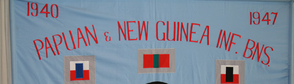
As a National Service 2nd Lieutenant, I served 17 months from January 1967 with the Port Moresby based 1st Bn Pacific Island Regiment whose regimental colours include the battle honours “Kokoda Trail” and “Kokoda-Deniki” and whose motto is “To Find A Path”. The PIR was formed after the war from the war time Papuan Infantry Battalion and New Guinea Infantry Battalions. The PIB made the initial planned ambush against the Japanese on the north coast of Papua on 23 July 1942.
From my experience with the PIR patrolling in remote country, my platoon often followed paths that were cut through the jungle between villages along our route. These paths were approximately 50 cm wide and were only identifiable, to me, by the remains of small finger width trees that had been cut when the path was blazed. We followedthe trail of these barely visible paths led by a local guide who also acted as an interpreter as he could understand the local languages of adjacent villages. Guides were regularly changed along the patrol route. (PNG then had a population estimated at 2.5 million and it was estimated there were 700 different languages.) It was not uncommon for adjoining villages to use different languages. It was also common that the villagers fought each other in, at times, lethal encounters. A police sergeant accompanied us on these patrols as “Police Motu” seemed to be a common language enabling him to communicate with remote villagers who did not speak “tok pisin”.
I imagine the prewar mail route to Port Moresby would have been similar to these jungle paths as it was not well used. Most of the villages along the route would have had different languages and probably fought each other. For example, the Koiari people who owned the territory centred on the village of Kagi had a reputation for being a fearsome tribe. When Kienzle first walked the mail route he could have been led by a member of the PNG constabulary who was familiar with the mail route and used Police Motu to communicate with the villagers. There was a Seventh Day Adventist mission near the village of Efogi which, I assume, would have been protected by the PNG constabulary and where the mail carriers from each end of the mail route would have met and swapped what they were carrying before returning to their start. To Kienzle he was following a trail that linked these villages.
The general staff called it a Trail presumably from Kienzle’s description of it in his first crossing. Another possible reason is that Brigadier Potts who commanded the retreat from Kokoda was a Western Australian and trail is commonly used in WA to describe tracks through the bush.
So why did some of – but not all – the troops call these multiple paths and multiple tracks a track?
I suggest these possible reasons:
a. After thousands of troops and carriers had used the mail route and the Myola bypass around the Efogi River gorge, the original mail route and the bypass would have become clearly defined with wider and seemingly continuous paths.
b. Most of the troops had no maps. In the jungle their vision would have been restricted and in their exhausted condition would have had no idea where they were until they arrived at a destination. The path they were following was a one and only path.
c. The Australian troops would have at some time marched to the tune of the popular Australian song of the 1920’s “Along the Road to Gundagai”. The words of which include “there’s a track winding back to an old-fashioned shack”. This song is quite rhythmic, and the music has a regular beat. It would have been used as a regimental marching tune as it was during my national service days. The word track would have been implanted in their thoughts.
d. They may have considered the word trail to be an Americanism. Trail is not an Americanism. Anti-American servicemen was intense at the time as evidenced by the Battle of Brisbane. Trail is quite a common word in Western Australia’s national parks. The Perth indigenous Nyoongar people have approved the use of the word trail in their description of the various paths they followed in their travels between Minim Cove on the Swan River and the chain of lakes in the western suburbs of Perth and between their camping grounds in the Darling Range. Signboards commemorating their traditional culture describe these paths as trails. The Camino Trail in northern Spain and the Inca Trail in Peru are other examples of the word trail.
I believe the Kokoda Trail is the right terminology for the war time route from Owers Corner to Wairopi. Kienzle and the generals were correct. The AWM’s choice of words “a path that linked” are the key. The paths between each village were not for walking to Kokoda from Port Moresby or Buna. They were to communicate with the immediate adjoining villages, but not the villages further along. These paths all overlapped to form a trail.
The Battle Nomenclature Committee adopted the name Kokoda Trail as the official British Commonwealth battle honour in October 1957, prior to McCarthy’s official history. They were possibly acting on the advice of the general staff who provided the strategy and directed the fighting along the trail and would have been aware of the significant involvement of the USA armed forces in the Kokoda Trail Campaign, which is either unknown to the majority of Australians, or ignored.
In PNG in 1967 the words “Kokoda Trail” were in use. The PNG post office issued a 5-cent stamp titled “Kokoda Trail” to commemorate the 25th anniversary of the start of the Kokoda Trail Campaign. At this time a wooden signpost displaying the words “Kokoda Trail”, was in place at McDonalds Corner on the road from Port Moresby to Koitaki. It pointed to a road leading to Owers Corner.

The words track, trail and path all have similar meanings. To my mind once a path has been cut and been used several times to become clearly defined it becomes a track. A track and a path are for walking between two locations. A trail is a series of overlapping paths, or tracks, between several locations along the way.
As mentioned by Peter Brune, “There were two pre-war and war time Kokoda Tracks; the Oivi – Kokoda Track and the Deniki – Kokoda Track.”
[ Note: John has undertaken the Kokoda hike twice – in 1967, with a Koiari soldier, from south to north; and in 2003, with a group of civilians, from north to south. John hopes that this article will trigger some discussion and debate amongst our readers.]